“You have to believe in something; I believe I'll have a beer.”

Stories with Photos

This page is an overview of random stories some short and some long. They are usually filled with photos, shocking surprises, intrigue and ironic endings. Ok, well at least there are photos.

Currently showing the story "Circumnavigation of Vancouver Island". Click here if you want to see the full list of stories available.

Circumnavigation of Vancouver Island

Sunday Jul 18, 2004

Photos (74)

Words (14124)

In 2004, we set out from Seattle to sail around Vancouver Island.  This is our chance to test the ocean waters with our new gear and to see the Pacific Northwest Wilderness one last time before heading south. We managed to photograph bears, whales, deer, eagles, dense old growth forests, hot springs paradise, and many cool anchorages and hikes.

Read about Bull Harbor to the NW Side of Vancouver Island with whales, gales and orca tails...

The English sailors used to talk about sailing to the tropics by giving the instructions, "Head south until the butter melts." For us, moss seems more appropriate. Especially as we start our southerly leg.

I'm writing this from the northern most harbor we will sail to for many years. From this point on, it's going to be a slow southerly drift to the tropics and beyond. The harbor is called Bull Harbor and it sits off the northeastern tip of Vancouver Island on an island called Hope Island. Bull Harbor used to be an old Coast Guard station, but it's long been abandoned leaving the island to the few natives who live here. We've been trapped here for almost 5 days waiting for fair weather to round Cape Scott. The winds have been howling for days.

But it is a great place to watch for good weather conditions and prepare for rounding Cape Scott and heading south. More about Bull Harbor later, there are a few things that happened in-between Seattle and here that I want to tell you about.

We left Seattle on May 15th and headed to Port Townsend to meet up with some friends on their boat. Prior to this, there was an impromptu going-away barbeque on the beach where dozens of people came to see us off.

The sendoff our friend's gave us made it tough to leave. Much to our surprise, some of them still wanted to see our ugly mugs a while longer and accompany us part way. Tuck took his boat "Annie" with Nancy and Jello (their black lab) as crew and met us in Port Townsend. Suzanne took the long drive via ferry and met all of us together for one last night of fun.

After relaxing in Port Townsend, and letting the idea that we finally left the dock sink in. We starting looking at where to go on our trip north. The following chart shows the south eastern places we visited after Port Townsend:

Roche Harbor, James Bay, Nanaimo, and False Bay

We crossed the Strait of Juan de Fuca from Port Townsend to Roche Harbor, bouncing and rolling, as is customary for the Strait. About half-way across, Sherrell spotted a puffin flying just above the water's surface, right past our boat. A pretty rare sight around here, but they have a protected breading ground on Protection Island out in the Strait. The little guy just went motoring on by us without even saying "Hey, look at me, I'm a puffin. You never see puffins around here do you? Well, sucker, check me out!"

Sherrell had never been to Roche Harbor, so we thought it would make a nice place to stop and get things organized on the boat. As typical with any long term departure from "civilization" you're never quite finished. Something about the human psyche I suppose. Sherrell and I have learned that the best way to deal with departure delays, is to just buy everything you think you'll need to finish your projects and then finish them as you go. Of course, the projects critical to operating the boat were completed, but about 80% of the work you do on a boat is trying to make life as comfortable as possible. At some point, you just have to go.

So in Roche Harbor, we organized several piles of hardware. Everything was rolling around loose and driving us crazy. Now was the time to find a space for our new spare manual bilge pump, the 180' of spectra line for the lazy jacks we are planning to make, the galley pump rebuild kit… oh, the list goes on and on like this. It amazes me the boat still floats.

Sarana anchored in Roche Harbor

While in Roche Harbor we had cellular coverage, so we sent out a few last minute email messages and said a few more goodbyes. We also went ashore and explored some of the craziness the locals were up to.

Someone had taken a large field and converted it into an art gallery. This was no small, country bumpkin showcase of art. It was a serious undertaking with some massive sculptures and very creative designs. They were also all for sale, ranging from $800 to $42,000 – outside our meager cruising budget.

One piece intrigued us to take a closer look. As you approached you saw the back of an easel with a canvas painting. Walking around to see the painting, you realized you were suckered by a mirror. I took the opportunity to make a portrait of a self portrait. I know—cheesy

After getting piles of our crap sorted out on the boat, we felt ready to cross into Canadaand start our trip. We left early hoping to check in at Bedwell Harbour then travel north to a bay we hadn't been to before.

The weather was ridiculously nice. This time last year, we had hail and 20 to 25 knots of wind. Now we were baking in the sun with no wind. We rounded Turn Point lighthouse while motoring through the current. Orcas are often spotted around here, and we kept an eye on the whale watching boats to see where they were going, but nada.

Turn Point marks the most Northern point of the US San Juan Islands.

After clearing customs, we bolted for James Bay on Prevost Island. We had always passed it by on previous trips thru the Gulf Island, since it seemed too exposed to the direction of the prevailing Northwest winds. But with the ridiculously good weather holding out, we felt safe to give it a try. There's a small state park there and it provides a great view of the other islands in the area.

But one of the things I don't like about the anchorages in this area, is crab traps. My main gripe is when people dump these things in the middle of an anchorage (always in the middle of the best spot too) and leave them for boaters to deal with. The one in our anchorage had an extra 100' of rope tied to it. So in the middle of the night, it silently drifted over to our anchor chain and wrapped itself around us.

We launched the dinghy to remove the pot, only to find a massive amount of kelp and weeds growing on this abandoned trap. As I was trying to unwind it, another boater motored over to help. For some reason he sensed the problem was that I was rowing and not motoring. He motored up, smiling and announced he had a motor and proceeded to grab the bow line on my dinghy and motor away at full speed. I tried telling him the trap is still tangled, but he seemed too excited by the prospect of dragging me around in circles, complete with our anchor chain. I held on tight as the line on the trap pulled taut and brought his speeding dinghy to an abrupt halt. He then helpfully informed me that the trap was wrapped around my anchor chain. I thanked him as we sprang back towards the boat. With the help of Sherrell's view from above and a sharp knife, I managed to unwind the trap.

My new friend excitedly fired up his little motor again. Together we pulled up what seemed like miles of rope before we got to the cage with a dead crab in it. You can see in the photo the big pile of green gunk attached to the line. I felt like tearing the cage apart, and throwing it up on shore, but the guy helping me didn't share my opinions about crab traps and insisted that we just move it. He floored his motor again, and hauled his strange tow to the other side of the anchorage...stupid crap traps.

We spent a couple of days relaxing in the nice weather before heading to Nanaimo. We hiked all over the island and thought about the upcoming trip. The boat still wasn't quite organized and some of the projects we hadn't finished needed to be addressed. Nanaimo, we thought, we'll do it in Nanaimo.

In Nanaimo, there is a great protected area where you can anchor for free and dinghy about a mile across the bay to get to downtown. The anchorage is cool because it is protected from nasty weather by an island that is also a provincial park. We had the best of both worlds: head north in the dinghy, and hike around the island trails or head south to downtown.

The park turned out to be huge. We've been to Nanaimo three times, but this is the first time we anchored and went to the park. Check out the little raccoon we saw roaming around and climbing trees.

While in Nanaimo, we knocked off a few of the major projects that had to be done quickly. We also worked on a few odds and ends trying to sort though the dwindling piles of boating hardware. I think we made some progress. We felt good enough to relax another day there and catch the fireworks for "Victoria Day" which, apparently, is only a big deal in Nanaimo. The view from the anchorage was outstanding.

We finally left Nanaimo after several days of getting things finished on the boat and buying some fresh veggies. The route to Desolation Sound requires a long slog up the northern section of the Strait of Georgia. We had planned to take advantage of the coming low pressure system to give us some southerly winds to push us north.

What we didn't expect, and neither did our Marine Weather Forecasters, is a full on gale. We started out the morning by drifting our way north in light winds, while we tried to test out our home-made self steering gear. But once we were an hour or so out of Nanaimo, the wind started to howl. We held on tight as the Strait of Georgia is one of the roughest sections of inside waters, due to its very long length. The waves build quickly and there's nowhere to hide.

About 3 hours into the gale the waves had built to 5' to 8'. Some of the larger waves were closer to 10'. Because the current was running in strange directions, the waves were really confused. They were coming at us from all angles. Steering through them was a tiring and difficult task. We wallowed and lunged our way towards "False Bay" where there was a small nook that offered some relief from the pounding we were taking.

Steering wildly downwind, running at 7+ knots with only the reefed genoa (we really needed the staysail but we foolishly didn't have it, or its rigging ready), we managed to jibe perfectly onto a course that took us directly into the bay and out of the storm. What a relief! The washing machine of Georgia Strait had left me bruised and tired. Sherrell was still trying to catch her breath long after we squeezed the boat into a tiny nook and set the anchor.

Although the Strait of Georgia gave us a whooping we wouldn't soon forget, we still had a lot of tricky sections to navigate along the Eastern coast of Vancouver Island. We planned to stop at: Squirrel Cove, Cameleon Harbour, Port Neville, Growler Cove, Sointula, Port Hardy, Clam Cove and Bull Harbor (again, you can click on the image to see a larger version).

The next day, the brunt of the storm had passed and we kept heading north, arriving in Squirrel Cove" in the evening. We had most of the bay to ourselves, only a few fishermen and a couple of Alaska bound cruisers were there. This bay is extremely well protected and we slept soundly without anymore thought to Georgia Strait. It was time to start thinking about the rapids.

There are three ways to get thru the narrow, mid-section of the inside passage along Vancouver Island, all of them with dangerous rapids and whirlpools, with current speeds faster than a raging river: Seymore Narrows, The Yucultas, and Hole in the Wall / Okisollo Upper Rapids.

Our favorite way is Hole in the Wall / Upper Rapids combination. The route is short and narrow (therefore tugs and ships are out of the picture), the rapids are closer together and the trip is more scenic. We came this way last year from Alaska and learned the hard way, that these rapids are still very dangerous and to only transit them when the tide is slack (you may recall the story about ripping down the rapids at 13 knots narrowly avoiding a 20 ft whirlpool on side, while avoiding the rocks on the other).

Fortunately, we timed them right this time and we whipped through the narrows right at slack water. The weather, however, was naughty. Lightening can be a scary prospect for people on a sailboat. You have a giant lightening rod protruding 50 ft. in the air and you're standing under it.

We've wired our boat to help avoid any strikes, but that's little comfort when bolts are coming down out of the sky. The storm came very close to us. The strikes were within 10 miles, but suddenly it veered and left us alone. Good luck with the weather has proven to come rarely, so we didn't jinx it by paying any attention to it.

We anchored in "Cameleon Harbour" where we saw a bear and cub last year. It is too early in the year for bears here, but we kept an eye out anyway. I occasionally called out "Here bear, bear, bear", but again, nada.

The next part of our route took us through some high current areas and then to This is where the good stuff happened.

We sighted 4 orcas (the camera wouldn't focus right so you'll just have to take our word for it)! One large male, a female and two tiny juveniles! They were feeding in the currents and occasionally surfaced near us. This was a really rare sight this early in the year. They were probably transients as the resident pods don't usually arrive in Johnstone Strait until June. We felt very very lucky. In fact, as we traveled further up into Johnstone Strait, the hotbed for Orcas, we heard that there hadn't been any sightings yet. The area resident pod disappears during the winter and spring (no one knows where they go) but they haven't arrived back yet.

After Port Neville we kept heading north up Johnstone Strait to a cozy little anchorage called Growler Cove which we used last summer as a base camp for Orca watching. However, since there hadn't been any sightings, and we already saw the transient family, we figured there wouldn't be much luck in spotting more whales.

Did I mention that it's been raining for days and days and days? We've had two gales and pouring rain. I'm getting mossy from it all. We're getting pretty far north, so maybe some of that moss will just freeze off along the way.

Some nights the temperature dropped down to the mid-thirties, with the days at a balmy 55-60 F. If we get a real scorcher, the inside temperature of the boat (without the heater) will hit about 70F. We haven't had anything close to a scorcher since Nanaimo.

After leaving "Growler Cove" we went to a new place (new to us) called Sointula. It's a small island village that was a hippie camp long before that word existed. In 1901, 800 people quit their crappy day job at the local mine, pitched in, and built themselves a communal town on Malcolm Island, calling themselves "Utopians". They were also, by chance, all Finnish. They were idealists who developed and built their own foundry, brickyard, sawmill, newspaper and a blacksmith shop. Everyone who joined the community either paid $250 or worked off the debt. Most people had to work off the debt. They had a tough go of it, but a few of the founding families are still there today.

They have a terrific bakery, by the way, if you're ever in town.

From the Finnish hippie camp, we went to Port Hardy, the logging, mining and fishing town. The anchorage there was rough as it facedQueen Charlotte Strait. Those folks with bigger cruising budgets could afford the protected marina. But we're on the "who cares if I have to crawl to the bathroom it's so rough I can't walk" budget.

When the weather was calm in the morning, we managed a trip to shore, for email, groceries, laundry, and all that crap that you think you don't need to worry about until it's gone. Oh, and we had to finish a few more projects and find someone with a drill press…normal stuff.

The boat in the far right of the photo is "Sarana" and directly behind my head is where all the nasty waves come from.

Beaten down after two nights of strong winds, we pulled up anchor and said goodbye. Only the anchor wouldn't come up! Tug, tug, tug, nothing. Hmmm, it appeared we wrapped the chain around something. Sherrell calmly said, "no problem." She drove the boat around counterclockwise once and the chain popped right out!

She made some sly comment about noticing we did a clockwise circle in the dark of night and somehow we must have wrapped the chain then. I didn't question it. We had almost 200' of chain to pull up from that deep, rough, bouncing, nauseating anchorage.

Seeking relief from Port Bouncy, we made a bee-line for a little land-locked cove called "Clam Cove". Clam cove has a narrow, shallow entrance and leads back to a waveproof lagoon that is about 15' deep with a muddy bottom. Perfect for anchoring and a great spot to wait out the storm that was predicted to arrive.

Just inside the entrance we saw two deer foraging at the low tide line. That's a good sign of a quiet anchorage.

We also saw hooded mergansers floating nearby on a log. They look pretty cool with their fashion stripes and hoods.

Meanwhile we rejoiced in the calm waters of Clam Cove after Port Sucks-a-lot. I guess we weren't quite hardy enough for Port Hardy. It's a good thing we moved to this anchorage, because the North Pacific raged during the night. Even in our land locked little anchorage, we were getting tossed by massive gusts. One of the weather stations about 4 miles from us reported winds over 45 knots.

While the weather did it's best to annoy us, we ignored it and went hiking. Clam Cove is on a little island called Nigei Island. I don't know how to say it either. The island has lots of lakes, and valuable "Canadian Timber" that you hear so much about. They used good old American style clearcuts to remove most of it.

There was some evidence that there had once been some old growth on the island, but most of it looks like second growth, and this will become third growth. It was fortunately replanted.

On the plus side, besides cheaper paper for you to print this on, the loggers provided roads up the steep hilltops. With the trees mowed down we had quite a view of the surrounding area.

That small white dot the arrow is pointing to is our boat. There's a fishing boat in there with us and a small float camp doing God knows what.

Looking out to the NE you can see the Walker Group, which is an island chain we anchored in last year on our way to Alaska.

After praising the calmness of Clam Cove's waters, and spending about three days just relaxing there, we headed for Bull Harbor; the place I'm writing this from. Most likely, if you've received this, we're further south. We've rounded CapeScott and we found someplace that has email and a computer with a CDROM drive. But let's get back to where I started off, Bull Harbour.

Bull Harbour is a long, narrow bay that leads north inside the island, well protected from the outside swell. On the other side of the island, about a half mile north of our anchorage, we can hear the large Pacific waves break on the beach. Just like the oceans I remember from California, Florida and Cape May when I was a kid. This is a proper beach, only it's friggin' freezin'.

We hiked over to the beach on the other side of the island, and saw a Minke whale feeding in the shallows of the bay (aptly named Roller Bay). The beach was long and sandy—something rarely seen around these young shores.

Sherrell watched him through the binoculars, diving and surfacing in the swells.

Before we can move on, we're going to have to wait at least a day, if not more (it turned out to be 4 days), here before attempting Cape Scott. There's yet another gale forecasted with winds to 40 knots again. I hope this summer isn't a replay of last year, where we had gale after gale followed by a nice storm. Fortunately we have tons of time to wait for the nice weather because we aren't planning to depart for California until mid-August.

We'll sit here a while longer looking for more whales. We heard that the grey whales are feeding out here this month, so maybe we'll get lucky and spot a few of them!

Read about the Big Blue and outside of Vancouver Island

This side of Vancouver Island lies in the open Pacific, the big blue. Before we get into our trip down the northwest portion of the island, let’s look at a chart of the cool places we’re going to see (the red dots highlight places we moored).

Well, we had to wait a while for big blue to calm down some before we sailed out into it. Cape Scott lies at the NW tip of Vancouver Island and juts well out into the Pacific. This cape is notorious for nasty weather and seas, and it was living up to its reputation. We had already waited 5 days in Bull Harbour for a break in the wind, which ranged from 25 to 40 knots and the gusts were higher.

Another gale was predicted for the evening of the 6th day, but the early morning brought calm weather and fairly smooth seas (4 to 6 feet). We decided to go for it. The first stage involved crossing the Nahwitti Bar. A bar is a shallow area at the entrance to a river or channel, where the swell approaches it from deep water and as it shallows out on the bar, the waves rise and can break, just like on a beach. This bar is complicated more by the 2 to 3 knot current that can run against it, causing quite dangerous conditions.

We had all this in mind, when we planned our departure from Bull Harbour. We waited for neap tides (weakest time of the month for current), and for the seas to calm down. We timed our departure for the last hour of the flood tide, which was heading in the same direction as the wind, making for smoother swells.

Crossing the bar turned out to be easy, although there was a hefty 2 knot current running against us, but the seas were smooth and relatively small.

The wind was light, so we motor-sailed for several miles as we approached Cape Scott. Since the currents are very strong off the cape, we had to stay several miles offshore in deeper water. Getting too close in shallower water (less than 100 feet deep), would be dangerous because the seas could turn very steep with the confused currents and maintaining control is often not possible.

We approached the cape nervously, as the winds started to fill in. There were several power boats ahead of us, who were chatting about the weather on the radio, so we didn’t feel alone, but they seemed concerned about the predicted gale as well.

Approaching Cape Scott

The wind had slowly picked up and of course it was coming from the direction we were trying to go. As the wind strength slowly increased, we shut down the engine and began the slow process of tacking along the coast in the building waves.

As we got closer to Cape Scott, the water turned more turbulent. Probably due to the current that splits down Queen Charlotte Sound and the outside of the island. It was a bumpy ride, but we were prepared for worse, and fortunately we had all our heavy weather equipment ready for its first true test.

Our goal was to make it to Winter Harbour about 60nm from Bull Harbour. Our backup plan, if the weather turned sour, was to turn into Sea Otter Cove where there are 4 mooring buoys. It was only about 38nm from Bull Harbour. If worse came to worse, we could just turn around.

Against our hopes, Environment Canada’s weather forecast came true, albeit several hours early. As we were about 30 minutes into sailing around the cape, the wind began to unleash itself on us. We were down to a double reefed mainsail and our staysail. (These are sail configurations that reduce the surface area of the sails so we would have the proper amount of sail power, but aren’t overpowered by the wind).

It was a good thing we had the boat rigged for heavy weather, because the seas became crazy turbulent and big. Sherrell was gaining her sea legs and starting to enjoy watching the approach of the increasing beam seas (seas approaching the side of the boat), and then feeling the boat confidently lift up, over and down them. As one particularly large wave was approaching, she pointed to it and said, “Oooh, there’s a good one.” Just as I looked over, the wave slammed into the side of the boat sending a stream of water over the dodger and right at me. I tried to duck but I ended up getting a little wet.

As I started to complain to Sherrell, “Aw, that one hit me,” I looked over to see water pouring off her head, and down her open fowl weather jacket – she was soaked all the way thru. That dousing put a quick end to her spectator sport. After that, I kept an eye on her, if she ducked, I dove for cover.

We tacked down the coast at a remarkable speed. With our new sail setup, we managed a good 5 knots into the wind (blowing 25-30 knots, gusting 35), despite the waves and surprisingly, having to tack around 3 different tugs pulling tows heading in the other direction.

Even though we made progress it was tough going, and we knew it was only going to get worse so we decided to stop at Sea Otter Cove. We weren’t too excited about the prospect though, as the seas were building and the entrance to the cove is shallow and very narrow, with rocks and reefs all around it. We had read that in such conditions, the seas can break all around the entrance sending foam right across it.

We worked the boat onto a course that would take us into the narrow and shallow gap on the straightest path. It wasn’t easy, and we had to tack several times in order to make sure we would clear the out-lying reefs. With our hearts in our throats, we dropped the sails and turned into the channel. The entrance was about 60 feet wide and there were wild waves all over the place. Sherrell had the fun job of keeping watch on the bow as we approached to keep us from hitting any underwater rocks, or just making a stupid mistake. As it was, the entrance was so small, I had to trust the GPS, because the opening was not visible due to the jumble of rocks and reefs. When we were about 300 feet from the opening, I could start to make out the path through the rocks.

With white knuckles, we piloted the boat through the entrance and around all the rocks to arrive in the very still waters of the anchorage. A small power boat, which we had seen in Bull Harbour, was tied to one of the mooring buoys. Later they told us they were surprised to see us come in through the entrance, because it looked like it was full of breaking waves and white foam. In reality, it looked much worse than it actually was.

We tied up to the huge buoy that looked like it was made for a ship and hung on. The boat was rocked by the wind and the choppy waves that were building up inside the anchorage. But it was nothing compared to the sea conditions on the other side of the reefs at the entrance. We could see the surf exploding on them, throwing spumes of water 10 feet over the top of them. Watching those breakers made us feel much better about having to just hunker down inside the boat, because there were much worse places to be. So we turned up the heater and waited. And wait we did--three days worth of waiting. We were beginning to wonder if the weather ever did anything other than rage against this rugged coast. These two gales, the first lasting 5 days, and this one seemed to be set on never stopping as well.

Sea Otter Cove as the storm was starting to break up.

Sea Otter Cover on the 4th day.

Finally the winds had dropped to below 30 knots for the first time since Noah landed his ark. Well, that’s how it felt (the winds built up to 45 knots during the time we were there). The seas were still quite disturbed out there, 10 to 14 feet, however, we weren’t about to sit there and wait for another gale. We busted out of there in a hurry.

The entrance was still being battered by these big waves. The entire opening was thick with white foam and waves crashing all around. After watching it for a little while, it looked safe to exit, but it was still pretty wild looking. Pushing the boat through the swells and into the deepest part of the channel I could find, we floored it. Waves were crashing and spraying on the nearby rocks like something out of a cheap Hollywood film. It seemed surreal and I wished I had a way to video tape the exit, because it was indescribable.

We sailed out of there heading for Winter Harbour. The large waves were good practice for us, and the wind conditions were ideal, about 20 knots. Not too much wind that the waves would keep building, but enough to give us plenty of control sailing through them. Sherrell tried to capture the large waves in a photograph. The wave rising up behind me is about 12 or 13 feet high. As another reference for scale, there was a 100 foot fishing boat out there with us that almost disappeared completely behind the troughs of the waves.

Sailing further south, it wasn’t long before we rounded Quatsino Lighthouse and turned up into Quatsino Sound where the waves quickly died down to a gentle nudge.

The weather seemed to be on our side and we were excited about getting some fresh produce in Winter Harbour, and being able to stretch our legs.

Alas, Winter Harbour turned out to be a tiny little village. Our guide book said, “They have a well stocked store.” They only had one stick of limp broccoli, 4 onions, some oranges and a bag of potatoes. We bought it all but the broccoli. They reassured us the owner was in Port Hardy with the delivery truck getting supplies.

We did laundry, hiked around their cool boardwalk which stretched for miles, ate salmon berries off the bush and waited for the delivery truck.

A fellow boater who was also waiting for the truck to arrive, told us the owner had called, and said he was leaving Port Hardy soon. She relayed to us that he hadn’t bought any produce, but agreed to pick some up since hearing that we were waiting for some. Then she started laughing as she told us, he was going to pick up some potatoes, onions, cabbage and carrots. Now anyone who knows anything about boating, knows that boaters always carry tons of these items because they last a long time without refrigeration. What we really wanted was tomatoes, zucchini, non-limp broccoli, etc.

We motored back to our anchored boat, deflated, and had some canned Indian food to cheer us up. Now don’t grimace, we did a thorough search of all the canned Indian food around until we found a brand that rivals American Indian restaurants, so we’re eating well.

After Winter Harbour we decided to check out Klaskish Inlet that sounded intriguing north of the Brooks Peninsula. The entrance was about 50 feet wide, with rocks and trees for walls.

We had the whole bay to ourselves and the sun was shining! It was the first day without rain we’ve had for almost 2 weeks. We dried ourselves out and prepared for the next big cape.

And Brooks Peninsula is a biggie. It juts out of the coast like a large brick for 15 miles. At the end of the peninsula is Cape Cook (yes, named after James Cook who came here in the 1700’s), and just off the tip is a small island called Solander Island. There’s an automated weather station on the island, and it ALWAYS reports the highest wind conditions along the coast of the island. Some people call it the Cape Horn of Vancouver Island. The similarity is mostly in appearance, I think, but it does have its own weather system and it’s usually the roughest spot along the coast.

We headed out early to beat the afternoon winds. The seas were not too bad, 4 to 6 feet. As we approached Solander we could see that the current was generating a lot of chop and strange breaking waves. So we headed out a little further for more sea room.

As we approached the island the waves got rough -- much rougher than we had expected. Steering any sort of straight course was impossible. I can only assume that the strong currents generated these strange choppy swells. Our guide book mentioned that this point of the coast is where the supply ships often have to turn around because the conditions can be very rough. The whole experience was a bit of a mystery to us. I’m not sure where the crazy waves came from or after rounding it, where the crazy waves went. But I could understand how this place could be terrible in bad weather.

We managed to rock and roll our way around the cape and the island and the choppy breaking swells quickly died off.

Now we were below 50 degrees North and in the so-called “Banana Belt” of warmer weather and fewer gales. Our next stop was Columbia Cove.

Columbia Cove is tucked into the south shore of Brooks Peninsula which has been preserved as one of the largest Provincial Parks. Supposedly, the peninsula escaped the last ice age, which has excited a lot of biologists with its many unique plants and fauna. The B.C. government had the wisdom to recognize its importance, and therefore protected it from logging and development.

At the head of the cove is a great hike through the tide flats and into the deep green old growth trees with huge trunks. The trail leads to a beach with beautiful white sand. After days of being storm bound inside the boat, and only having the board walk for a hike since Bull Harbour, we were in heaven. The sun was incredible and we could smell the fragrant forest teeming with life. But the highlight of the hike was emerging from the dark forest and strolling directly on to a bright sandy beach with waves rolling on the shore. The view stretched out into the sky, as if we were suddenly transported to Hawaii.

Of course there was the reminder that this was still a Pacific Northwest Beach: about 40,000 trees on the shore.

The air was so clean here and the sky a rich dark blue. Being the only two people for as far as we could see made this beach a special place for us. I even went swimming in the waves and we spent several hours relaxing on the hot sand.

Columbia Cove was so nice that we stayed an extra day to play on the beach and look around. We found the remains of an old steal Coast Guard Cutter that was slowly falling apart; in fact we rowed over one of its 12 cylinder engines. Only about half of the wreck is still recognizable. But I liked the photo for Sherrell’s artistic skills.

Did I mention that the weather has been fantastic? The temperature inside the boat (without the heater) reached an all time high of 87 degrees! The humidity dropped to 32%. Both of these are records since last summer. We’re hoping that this is the banana belt effect and that it will hold out.

Basking in the warm weather, we planned our next stop solely to see sea otters.

These little guys are very different from the river otters seen in the inside protected waters (contrary to their name, river otters also live along the seashore). They live for the open ocean and the cold water. The fur traders encouraged the First Nation people to hunt them and skin them for a few chunks of copper, maybe a gun, or some booze. The Sea Otter’s skin has the highest density of hair of any mammal, with up to 160,000 hairs per square centimeter. Imagine that! I think I have about 5. Naturally a thick coat like that was in high demand, and by 1929 they were completely wiped out from Vancouver Island. In an experiment to restore their population, a group of 90 were transplanted from Alaska in 1969-1972. By 1995, their population had reached about 1950 along the coast. Along with their recovery, the sea urchin population is back in control, which helps to keep the kelp forests strong.

These little “sea dudes” are really funny to watch. They roll in the sea, turn flips, and float on their backs with their feet way up in the air. Often they emerge from under the water with a clam or an urchin, and a small rock. While floating on their back, they rest the rock on their belly and crack open their snacks.

This one has his hands on the side of his head, combing his fur back for the camera.

The anchorage was nice too. We were in a spot called Scow Bay with tons of little islands and places to take the dinghy to explore. The spot where the next photo was taken from completely dries at low tide.

Not to mention that the sunset at Scow Bay left us speechless.

There’s lots of sea life too. Here’s one of my favorite animals, the sunstar. It’s the biggest and the fastest starfish on the planet, and it’s only found in the Pacific Northwest.

Check out how this guy blends into the texture of the barnacles and the rocks.

In our exploring we also found a large animal skeleton, minus the skull. We tried our hand at rebuilding the creature, but I think we must have misplaced something. Anyone know what this is? There are some crazy shaped bones in there, so we figure it is probably a marine mammal of some kind or maybe it’s the missing link.

We left it behind to confuse the next person who lands on this remote beach, and headed back to the boat to get ready for our early morning departure.

We set off for Walter’s Cove in the thick morning fog. Navigating by radar and GPS we transited a hodgepodge of rocks and reefs called the Broken Islands. There were a lot of kelp beds everywhere, which are magnets for Sea Otters (a.k.a. Sea Dudes, their scientific name).

We were turning around one of the fog shrouded points, when Sherrell (looking through the binoculars) gasped, “Oh, my god! You’ve got to see this!” She handed me the binoculars and pointed into the haze with an ear to ear grin. I looked at the lumpy kelp bed and suddenly realized those lumps were Sea Otters! There must have been over a hundred of them! We circled back for photos, being very careful not to get too close and disturb them.

We left them to their otter business, and felt our way to the next cove. Walter’s Cove turned out to be a small town and the store was open only a few hours every day, with no water, no fuel, no laundry. As it was, we were lucky, and managed to pick up some of the last fresh produce and two bags of ice for our icebox. We made ourselves a big pot of Thai Curry with the fresh veggies.

Here’s a picture of our boat at the dock, one of the few times we’ve gone to a dock (mostly because it’s free at Walter’s Cove).

From Walter’s Cove we headed up Kyuquot Sound to a place called Dixie Cove. The route took us inside a long chain of broken rocky reefs called the Barrier Islands. They’re sort of eerie, especially in the fog. We managed to get a few pictures, but it was hard to convey the three dimensional depths as the openings in the reefs would grow and shrink as we passed by and the surf would crash randomly against them mixing briefly with the wisps of fog.

The reefs were probably the most scenic, if not dynamic, part of this leg. After all that, Dixie Cove was a nice spot, well protected, but nothing too spectacular. After Dixie Cove, we headed back out into the big blue, in pea-soup fog, to enter the southern portion of Vancouver Island. The fog was so thick that we had to abandon our plan to go inside a series of reefs known, ironically, as Clear Channel. The visibility was just too poor to put ourselves in such a tight spot, relying only on radar and GPS to feel our way around the rocks.

So we headed deep out into the sea, then back south again to round another point, all the while, I’m blasting our fog horn, because there are a lot of tiny speed boats who run full throttle through the fog. They don’t have radar and they just hope others see them coming. Since the visibility was less than 0.25 mile, we had to keep a close eye on the radar for moving spots.

After we were about 3 miles or so offshore, the fog cleared some, and so did our tension. We rounded a smaller cape and headed up into Esperanza Inlet to anchor in Queen Cove for the night. This area is officially West Vancouver Island South, so it seems like a good place to stop writing for now, besides we’re only 30 minutes away from our next town which is supposed to be much bigger than anything we’ve encountered on the West Coast so far, and we’ve got boat fever bad!

Read about Final Leg Around the SW of Vancouver Island

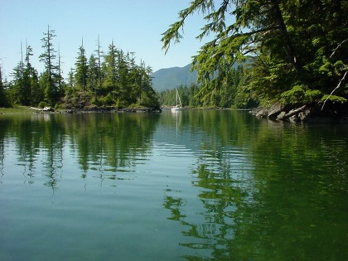
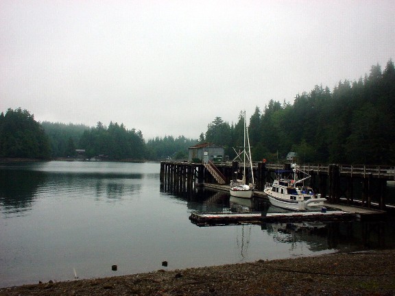
In the last section we wove our way around the Barrier Islands in the fog, headed out into the open water, around the next point and anchored in Queen Cove.  Our guide book had hyped up Queen Cove, so we were quite disappointed to find houses all around and clear-cuts.  Another large sailboat came and anchored near us, but the wind was blowing hard so all of us just stayed hunkered below.   We found out from other boaters later that this sailboat from Seattle, had been there two weeks just puttering around and anchoring there each night.  It was beyond us why they picked Queen Cove as a base camp.

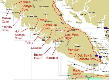
The southwestern portion of Vancouver Island is very large, and we wanted to see as much as possible.  Spending two weeks in one place just didn't sound like fun.  In fact here's an overview of all the spots we hit along the way.

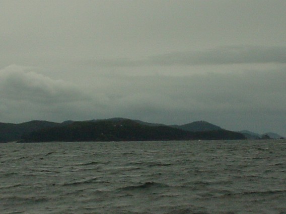
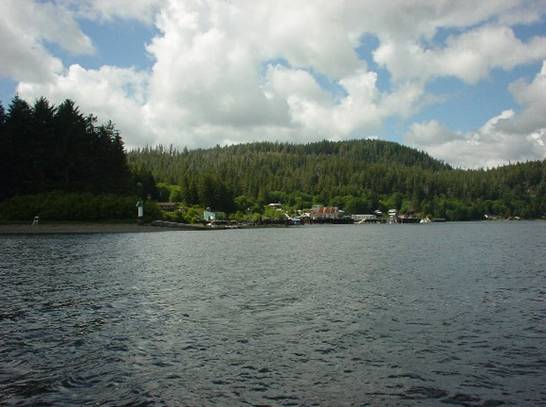
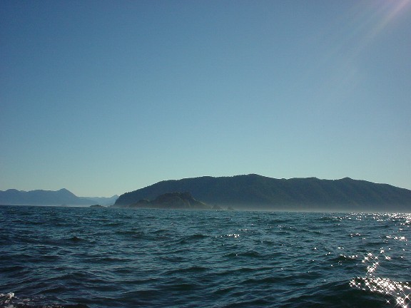
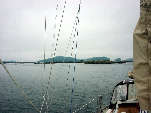
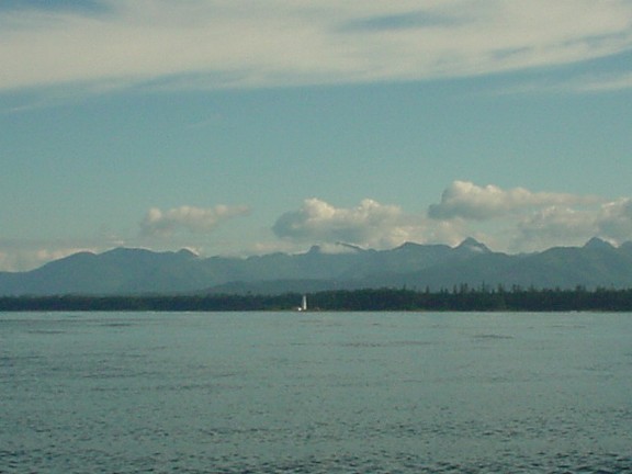
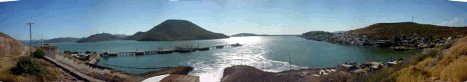
So with so many places to go, we left this sailboat to enjoy the clear-cuts, and headed up an inlet to the small town of Zeballos.  We were promised restaurants, fuel, water, and a "well stocked store."

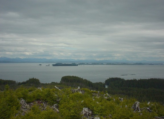
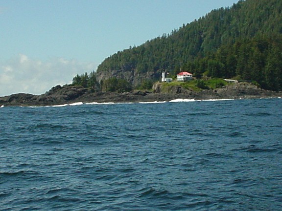
APPROACHING ZEBALLOS

Fortunately for the authors of our guidebook, Zeballos lived up to their promise.  We were able to get fuel, water, do three loads of laundry and even topped up our propane tank.  The best part was of course having a rare dinner out.  We checked out all four (yes a glorious four choices!) restaurants before going with the one with the vegetarian chef.  He even came out of the kitchen, shouting, "Ok, so whose the vegetarian out here?!"  He fixed us a special entree and commented that it's tough out here because everyone eats meat.  He was quite impressed to learn we were both vegan.

After a great dinner, we learned that there was dial-up internet access at the library (open Tues/Thurs. 3pm to 5pm).  Since it was Wednesday, we were tempted to skip it because we didn't want to pay for another day at the dock.  After consulting our charts, we decided that we could leave at about 5pm the next day and still make it to the next anchorage before dark.

We waited outside the library like nerdy school kids for the librarian to open the doors.  I was armed with two long stories to email out on CD and on a USB mini-drive (thanks to Wayne who gave me one!).  Their ancient computer couldn't read any of these, and our internet plans went bust.  On the plus side, Sherrell did manage to pay a bill before getting a late fee, and we shot off a few short emails to our parents so they wouldn't worry.

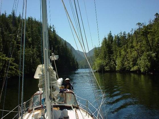
The downside of waiting so late in the day to depart, because we're too cheap to pay for another day at the dock, meant trying to get to the next anchorage before dark.  Traveling these log-filled fjords in the dark can be a risky business.

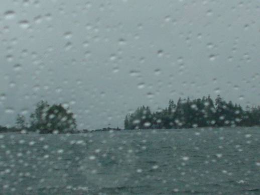
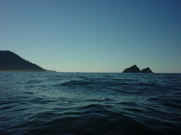
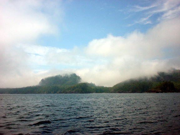
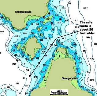
Our goal was a small cove north of Bodega Island.  The cove is a land-locked little basin that is really well protected, but with the strong head-winds, adverse current and the setting sun against us it seemed dicey getting there.  As a backup, there was a smaller cove in very deep water, which we would have to set two anchors to keep from swinging into the deep water.  After a long evening of trying to get through the fjords, we took a look at the deep water cove, and decided to press on to a better anchorage.  The impending darkness encouraged us to take a short cut through Princessa Passage;  a short, but narrow, shallow and rock filled section that would cut an hour off the trip.

The current through here sometimes rips along, and it's easy to get set against the rocks.  Gripping the tiller while Sherrell kept lookout on the bow, we floored it through there to limit the amount of drift caused by the current.  With the rocks and islands in such close quarters, traveling next to them at 6+ knots can really feel like a slalom ride.  We weaved past the rocks and dodged the outcrops on the islands in a matter of seconds, but when you're unable to breathe, it seems like minutes.

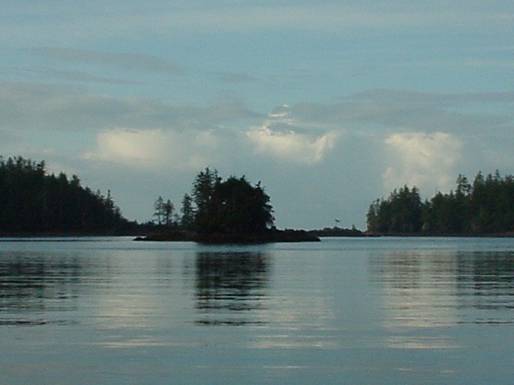
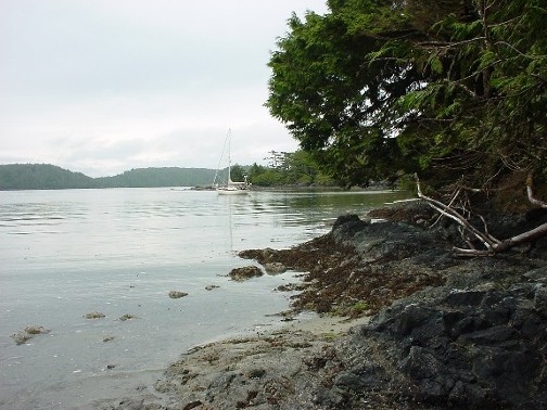
Once we caught our breath and turned up into Bodega Cove, we felt vindicated for going the extra distance.  There were lots of birds--we could almost reach out and touch a large eagle when we came through the entrance.  And there was a large tidal flat that was cool for hiking.

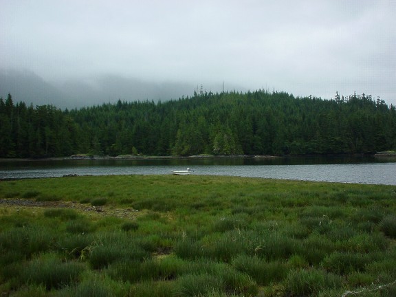
We landed our dinghy on a beautiful grassy meadow (prime bear real-estate).   Hiking through the area revealed a small stream and some pretty fresh bear scat.  Since we had heard that bears are sometimes sighted here, I let Sherrell lead the way.

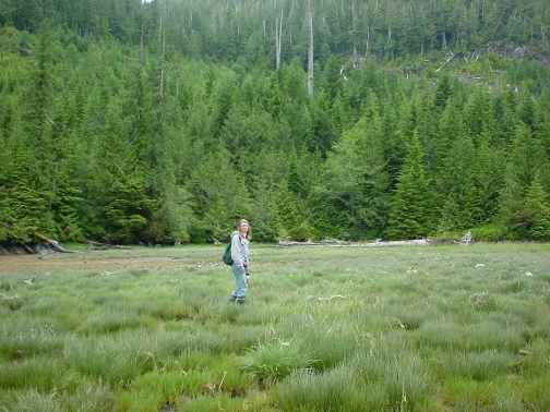
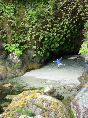
We spent an extra day at this anchorage, just to relax and hopefully catch sight of a black bear.  Since you only see the photo of "Bear-Bait" Sherrell, you can guess we didn't spot any.

From here we motored down to "Friendly Cove".  This was the historic site where in 1778 Captain James Cook "found" Nootka Sound and repaired his vessel with the help of friendly natives, thus the name of the cove.  Well, Spain had claimed sovereignty over the Pacific Ocean since 1494 and when they sent someone to whoop up on the other Europeans who started trading Sea Otter pelts, they were pissed.  In 1789 Don Estevan Martinez from Spain arrived and took possession of the port and the "foreign" vessels, which were commercial vessels.  After some political hustle and tussle, they worked out the "Nootka Conventions" in Friendly Cove.  This laid the groundwork for laws that still stand today regarding foreign flagged commercial boats, which allow them the freedom to move about the seas, despite the current political environment of their homelands.

The story takes a more interesting twist when Chief Maquinna, whom had witnessed all this nonsense, moved out of the area to avoid the conflict between Spain and England.  But in 1803, another ship out of Boston arrived in a nearby cove hoping to make a fortune on Sea Otter skins like the ships before him.  The Chief, however, had learned their true value, and knew he had been getting ripped off for years.  He greeted the ship and John Slater warmly as usual.  John Slater gave him a gun for shooting foul, and the Chief returned with several ducks for him and showed him one of the gun's locks had broken.  John took this as a gesture of contempt and belittled him with a long string of salty sailor swearing.

Well, that night, the Chief and the elders hatched a plan.  They got Slater to send 9 men ashore and in a surprise ambush, they killed them in bloody hand to hand combat.  They then proceeded to kill 24 of the 26 men on the boat, leaving the metallurgist (for his skills) and a man found hiding later to serve as slaves.

Chief Maquinna's tribe was now the only one equipped with an armed sailing vessel.  They took the cargo and moved the ship to Friendly Cove, where they burned it to the waterline.  The white slaves were eventually freed, and they had the wisdom to encourage the English not to punish Chief Maquinna as it would fuel an endless cycle of violence.

The bay isn't very large.  It is also open to the ocean, so some swell from the Pacific enters, but despite all this we had to check this place out.  We weren't the only ones to feel like strangers on these old shores.  In fact, in 1788 John Meares dumped two Chinese carpenters off in Friendly Cove and told them to build a ship.  He returned to find the ship completed, and in Sept. 20, 1788 a schooner was named "Northwest America" and was the first ship ever built on the West Coast.  Imagine being dumped on a remote foreign land and being told to build a ship with only the tools you have on you...sheesh.

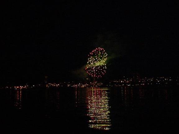
Anyway the weather was calm and the anchorage wasn't too crowded when the tour boat wasn't around. (This photo is taken from the Coast Guard Lighthouse).

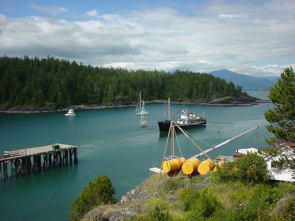
Our boat is anchored in the middle, just off the bow of this large local tour boat that is backing away from the wharf.

This was once a thriving native village, but only one native family lives here full time now, as caretakers.  The rest moved onto a reservation next to a white town to work at the lumber mill.  Back when this was a thriving village, the natives built a pretty little church, after being converted to Catholicism by the Spanish.  Several years ago, the elders decided it was time the tribe got back to their native roots, and replaced the altar with these beautiful totems.  Now, it's really dedicated to their beliefs, rather than Christian dogma. 

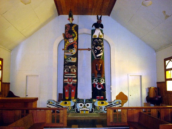
The totems are family totems with the various spirits that signify importance in their family.

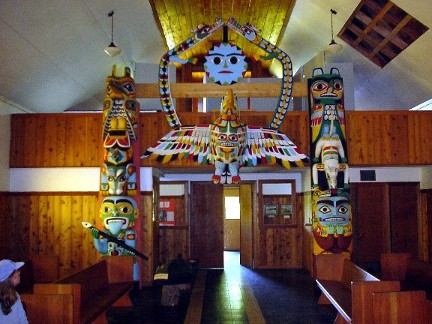
The back of the chapel was even cooler.

During ceremonies they can lower the Thunderbird down to pickup the Orca (the dark black spot on the floor to the left).  The Thunderbird lifts the Orca up and then spits oil out of it's beak onto a fire.  Its an old tale about the beginning of the universe.  And I'm sure it's spectacular to watch, especially with the Thunderbird spitting fire in the middle of church!

From the church we hiked down to the pebble beach and explored some of the amazing rock formations.

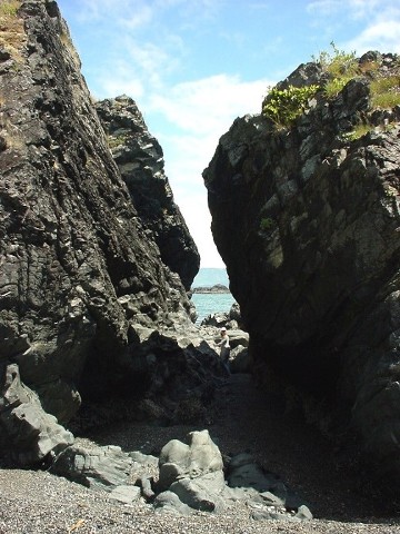
Can you see Sherrell in there?  We hiked for miles along the shore and through the reservation checking out all the critters. 

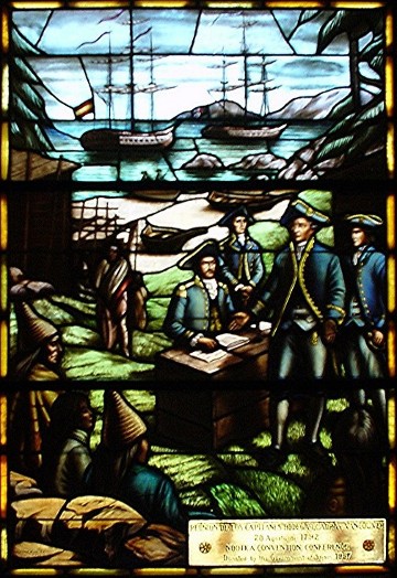
Before we left I had to take a look at the stained glass window donated by the government of Spain to this tiny little band.  The glass depicts the negotiation of the Nootka Conventions between Spain and England.  I noticed a distinct LACK of  recognition from England.  Perhaps they're still pissed about their boat and the tragic loss of their countrymen.  (Notice in the glass that was given to the natives mind you, how the natives are sort of off to the side and incidental?  Also notice that the Spanish ship is closer and more prominent than the English ship?)

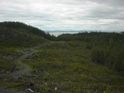
We sat aboard Sarana thinking about how much history happened here and how very little the First Nation People got out of the deal.  The total land given to this tribe by Canada was about 600 hectares (1483 acres).  A sliver of an area of where they used to be free to roam.  Almost 75% of what Canada took is being clear-cut or is planned to be cut.  This includes many old-growth strands of trees that are centuries old.  In fact, the nearby Nootka Island is almost a total wasteland of clear-cuts.  Such a sad legacy.  And to think, archeologists have proven there has been native settlements in this area continuously for over 4,300 years!  And now they barely have a pot to piss in.

We slipped quietly and somberly out of the harbor in the morning and sailed to a spot we hoped would ease our bodies as well as our souls:  Hot Springs Cove.

As we rounded Estevan Point (remember Captain Don Estevan Martinez from earlier?) we shot a picture of another historic site:  Estevan Point Lighthouse.  It was poured almost continuously and holds the dubious honor of being the only place in Canada ever under attack by a foreign country.  Can you believe it?  I guess during WWII a Japanese sub took a pot shot at the light house and tried to tear it down.  Obviously they missed.

We were able to sail almost all the way into Hot Springs Cove.  We were so excited about soaking our tired bodies in the hot sulfur water.  Little did I know that this place would be proof that there is a Heaven.  Heaven, it turned out was hidden here all along!

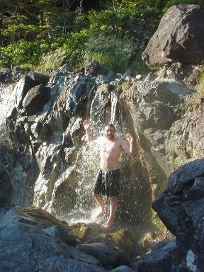
This steaming hot waterfall is pumped out of the Earth from over 5km below.  It's heated to 104° Celsius (hotter than boiling for you standard folks) and is cooled to about 50°C (about 130° F, I guess) when it exits the Earth's crust.

I was beside myself in disbelief.   Who could have ever imagined something so amazing here in the wilderness?  A hot natural shower powered by a 5km underground natural pump.  Magic isn't it?

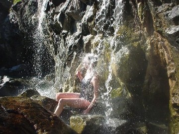
This waterfall fell into several pools which were progressively cooler.  My favorite was right there at the top.  I laid down in the pool and let the waterfall just pour over me.  The deep pump in the Earth would irregularly speed up and slow down the water kneading my tired muscles.  I felt like the water was under control of some unseen spirit, gently searching for all the sore spots.

I laid there in bliss with my body immersed in the water with only my eyes and nose poking out.  The sweet rumble of the water and it's random massaging hot water was wonderful.  And before you think I've lost it, you're not the only one.  I encouraged Sherrell to try my spot of Heaven and as her face was sprayed by the steaming water she sat up quickly and said, "That sucks its going up my nose."  Perhaps my heaven isn't for everyone.

Sherrell did enjoy the steamy shower, though.

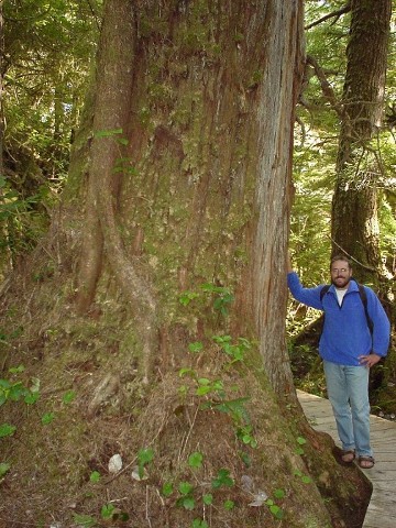
And the trail to get to the Hot Springs is a 2km long trek along a nice boardwalk through old growth trees.  Some of them were massive!  We guessed they had to be 400 to 500 years old! 


After spending two days soaking in the hot springs, we started heading towards a bay near a Native Reservation called Ahousat.  Leaving Hot Springs Cove, we felt refreshed and ready for more travel.  As we exited the cove and turned up the channel, Sherrell was raring to go and suggested we hoist our spinnaker.

We bought the slightly used spinnaker in Seattle and hadn't had a chance yet to see how it fit our boat.  Well, actually we tried to pull it up to the top of the mast once in very light wind while at the dock on Lake Union, but it quickly filled and just about pulled us onto the boat next to us.  So, I quickly announced that the spinnaker would fit, and doused it like a madman.  The truth is we didn't know if it would fit, or if it was even the right type of spinnaker (asymmetric), but at $150 bucks and with it in great shape, we chanced it.

Sherrell said now was the time to test it out -- light wind, flat seas.  So I set to rigging everything up (also for the first time on our boat).  I walked Sherrell through the basics of handling the spinnaker, and then promptly hoisted it into the sky.  It quickly filled with air, and I realized to my chagrin that it was sideways.  A little flustered, I doused it, rotated it (marked it for future reference) and hoisted it again.

It went up cleanly and opened to reveal its black, yellow, orange, red and white glory, or should I say gory.  At any rate, the big bright sale filled magically and started pulling us through the water at 3-4 knots.

Unfortunately it turned out to be a symmetrical spinnaker, and a little too small for our boat.  However, with some creative trimming, I was able to make it fly nicely as a pseudo-asymmetric.  For the price, we'll take it!

Sherrell really enjoyed the spinnaker once we got it up and going the right way.  I talked some more about some of the things that usually go wrong with them and what to look for as the wind gradually built.  To avoid having any of those bad things we were discussing come true, we doused the spinnaker in what turned out to be minutes before the wind really started blowing.  Trying to take down a big sail like that in a lot of wind (in a narrow channel, nonetheless) can be an ugly scene.

We sailed on with just the genoa and worked our way around to the little bay by Ahousat.  The bay borders a marine park and the Native Reservation.  We went to shore and hiked several miles through DEEP mud bogs.  These mud bogs were the type that suck you down and don't let go.  They're the type of bog that makes those wet slurping sounds as you struggle to pull your boots (knee high boots) out of them before the mud oozes inside.

Slipping and slogging our way through the trees we emerged onto a powdery sand beach.  The soft powdery sand was a dramatic change from the sucky-mud.  We walked along the shores and found another path that had recently been made, but this time most of the trail was a boardwalk.  Having left our boots behind in the sand, we decided to attempt it barefoot.  We "oohed" and "ouched" for about a half a mile until we emerged onto another beach.  This beach lead to the "Trail of Tears" built by the Ahousat natives.  This trail is a 15km march to Cow Bay (where grey whales often feed).  Lacking shoes, the trail of tears sounded a little too much for us, so we turned back for the boat.

The next day we headed out for Tofino, one of the largest towns we've visited.  Tofino is a major tourist destination for land-locked Canadians.  They were here for the long weekend (Canada Day) and they packed the town.  Even the marina was full and we had to reluctantly raft with a surly sailor in his big blue boat.

Tofino also turned out to be a Mecca for surfers.  There were posters of surfers riding the tubes and doing tricks on the icy water on the west side of the peninsula.  Tofino sported a strong counter-culture of surf bums.  The local monthly newsletter even featured a surfing trick of the month, executed nicely by one of the local surfing experts. 

Several residents didn't seem to appreciate this invasion.  The middle class method of protest, the bumper sticker, promptly declared:  "Hippies Suck".

Despite all of Tofino's tourists, we were able to restock and get underway quickly to go to another historic site in a bay known as Adventure Cove.  This bay was where the first boat to circumnavigate the world with the United States Flag was built.  It sounded like a good spot to check out.

Captain Grey built a 45 ton sloop and sailed it around the world.  I was surprised to learn that the first American to sail around the world built his boat in an obscure cove in Canada.

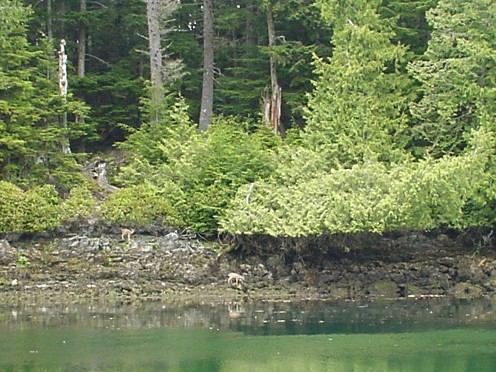
What we found in Adventure Cove turned out to be much more interesting than an old archeological site.  We found a big black bear!

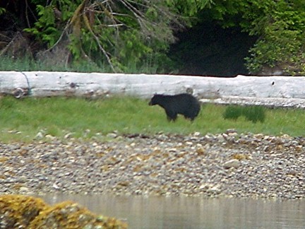
He was there for several hours in the evening and the morning just eating different grasses and rooting around in the low tide line.  He was patiently combing the shore for snacks and was fun to watch.  Since he was busy at the archeological site, we let him enjoy it alone.  Captain Grey will have to wait for another day.

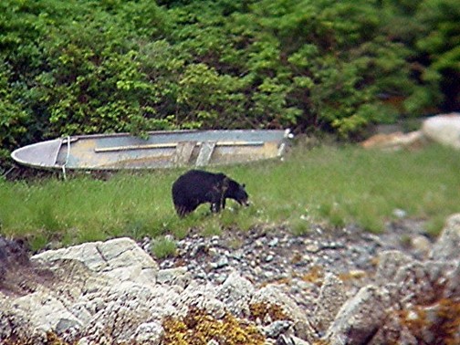
Early in the morning "Barry" was up and looking for more snacks.  Since we decided to head to the next stop, Ucluelet, before the tide changed, we raised the anchor and got underway.  All the while, Barry didn't even notice us and all the noise we were making.

For the third time, we wound our way through the rocks and shallows (about 10 to 20 feet of depth under the boat most of the way) with shoals on all sides, towards Tofino.  Nearing Tofino, we turned south and headed back into the ocean for a 16 mile leg offshore.

The wind had picked up and was blowing directly at us, so we were unable to sail.  As we moved further offshore, the boat started to slow to a crawl.  We were over 3 miles offshore in the middle of the open water, but suddenly there was 3 knots of current against us.  We were barely making 2 knots and the short 16nm leg was looking like an 8 hour slog.

After battling the current for a couple hours, and searching all of our sailing references for some mention of this phenomenon, we opted for hot showers and doing a load of laundry back in Tofino.  We turned around, put the sails up, and did a brisk 8 knot sail back to Tofino in less than an hour.

To save money, we tied up to the very busy, but free, public pier and went in search of someone who might know about the currents, so the next day we wouldn't waste our time fighting it.

We found a cool fisherman who agreed it can be a slog out there heading Southeast, as the prevailing current generally sets Northwest.  We speculated it had to do with the Straits of Juan de Fuca dumping into the ocean.  He was a pleasant guy who had traveled to many of the same places in Asia that we did in the early '70's.  We exchanged stories of Singapore and how dramatically it has changed since the '70's when it was a fledgling 3rd world country.  He was surprised to hear of how it's a strong 1st world country with all the modern conveniences to rival Tokyo.

Parting ways, he wished us luck, and we went off to do laundry and take showers.  Upon returning to the busy public dock, we found several friendly and tipsy Ahousat natives hanging out on the pier.  When they saw us climb aboard our sailboat, the whole group lit up with excitement.

Realizing we were the ones on the sailboat, brought a flurry of questions.  How big is it?  Where did you come from?  Did you name it?  What does SARANA mean?  After being alone most of the trip without a lot of people around us, we felt overwhelmed by the crowd and tried to answer their questions as rapidly as we could.

There was one pregnant woman there who liked the boat name so much, she decided on the spot that if she had a daughter, she would name her Sarana.  She made us write down the information for her and we helped her pronounce it several times.  The group was waiting for their local watertaxi to give them a ride back to Ahousat, where a 5 day sports festival was underway.  They practically demanded we go with them.

After debating it for some time, we decided that backtracking that far would really slow us down for another 4 days.  Other members of the Ahousat band came by later that day and invited us over for the festival too, it was a bummer it was so far out of our way.  Too bad we didn't know about the party several days ago when we were there.  Sadly, we had to press on.

To beat the tides we departed at 5:30am, but not before the last Ahousat could say goodbye.  At about 3am, there was a knock-knock-knock on the hull.  I stuck my head out to see one of the guys we had met earlier holding up 2 beer bottles as an invitation to join him.

We laughed and I apologized that I couldn't join him.  We were departing early and I was dead tired.  When 5:30am rolled around, we quietly left the pier where his slumped form was sleeping in the morning dew.   Sometimes it is easy to understand why some of the reservations choose to go dry.

Leaving Tofino, again, we had much better luck.  With a slight wind from behind us, we flew down the coast at over 5 knots.  An amazing change from the grueling crawl the day before.

Rounding the lighthouse 16nm later, we approached Ucluelet, the town on the west side of Barkley Sound.  Only 30 minutes by car from Tofino, Ucluelet was much quieter and was surrounded by hiking trails.

We hiked about 15 km along the rugged coastline we had just traversed by boat.

We left the main trail and bushwhacked some along the shoreline, until we ran into a rather tame white-tailed deer.

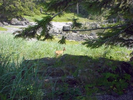
This little guy became our local tour guide and led us through several animal trails for about 15 minutes, until deciding the pay wasn't good enough and ducked off the trails to wait for us to pass on our own.

The hiking was great, we really wore ourselves out.  We collapsed in the cockpit of the boat, and then grilled up some delicious Portobello mushrooms that we scored in one of the stores.

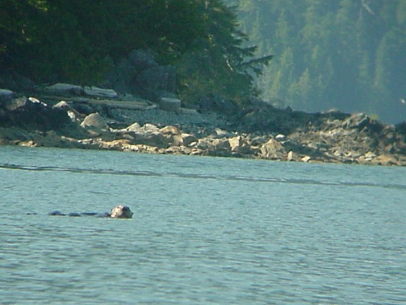
The next morning we set off in the wispy fog for Lyall Point Cove where lots of puffins have been sighted.  While winding our way through the reefs, a large Gray Whale surfaced 10 feet from our boat!  Sherrell thought we were goners, but I grabbed the camera and waited impatiently for it to power on.

I slammed the boat into neutral and while I was searching the water for the whale, I realized the stupid camera still hadn't turned on.  I gave it a good shake, just to show it who was boss as I spotted the whale under the surface of the water.  He had turned the other direction and was on his side looking up at us from under the water.  I could see his large eye looking at us from his watery home.

Just then he turned over and lifted his spout out of the water and blew a 15 foot high plume of water into the air.  The damn camera still wasn't ready to take a photo.  As he started to slip back below the water, the camera finally was ready for action, almost a second too late I snapped his picture.

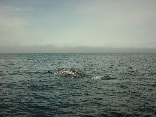
As he sunk below the surface, an obnoxious smell overtook us, like rotting fish and seaweed.  Sherrell and I made faces at each other and said at the same time, "Whale breath!"

We hung out there for a little while longer to see if the beastie would come back, but he seemed to have gotten an eyeful of us and dove deep.

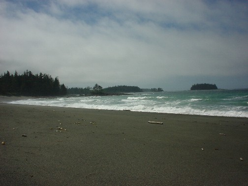
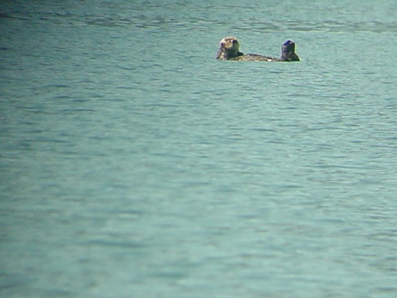
Sherrell's adrenaline rush lasted the last 8nm to Lyall Point Bight.  This is a small indent into Vancouver Island.  The anchorage is exposed to the west and northwest, but our guide book proudly declared there were lots of seabirds in this area, including the colorful tufted puffin!

A good 20 hours into watching for puffins, we spotted an amazing zero.  In fact, there were no sea birds whatsoever, not even a seagull!  Stupid guide book.

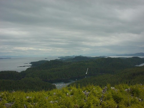
Fine then!  Onward to the Broken Group!  They have a funny name, but if you were to see them on the chart, it would make sense.  The Broken Group is a pile of islands, rocks and reefs in the middle of Barkley Sound.  They cover an area less than the size of the San Juan Islands in Washington (about 15 miles by 15 miles), but there must be about 200 or more islands.  Hundreds of kayakers come here every summer to paddle in and out of all the rocks and islands.  This is paradise free of clear-cuts.  The Broken Group is fully protected as a Marine Park by Canada, thank God, because nothing seems to be safe from the saw out here.  It's a good thing our mast is metal....

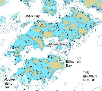
We decided to start our introduction to the Broken Group by anchoring in Joe's Bay, which is large bay formed by a ring of 5 islands.  On the chart it looked protected in all directions, even though it's a stone's throw from the Pacific.  Gale winds from the northwest were forecast for the next two days, so it seemed like a good place to hide. 

Since this was the first gale for the southern half of the island for the last two months, we were a little skeptical, but we didn't take any chances.  And neither did the other 11 boats that shared the anchorage with us.  This is the first time where we've been in an anchorage and had more than 3 or 4 boats.  It was strange, but we sort of expected more crowds.  This area is easily accessible to American and Canadian boats from Victoria and Seattle.  Almost our entire time in the Broken Group, we saw nothing but American yacht after American yacht.

We tried to pick a spot out of the wind and away from the other boats so we would have room to swing around on the anchor.  After about 2 hours, the wind had built to about 30 knots and the boat next to us started to drag anchor.  They started dragging towards a rocky reef, but they were quick to recognize the problem, and pulled their anchor up and moved to a new spot.

Another 2 hours passed and the gusts had increased in strength.  And for the first time since we've had the boat (7 years), we started to drag.  It was a little surprising because we have a very large anchor, and all chain rode.  We quickly pulled up the anchor and headed for a spot with fewer gusts.  As we dropped the anchor, we came to the realization that there was some kind of misunderstanding between us about the depth.  I hadn't put out enough chain the first time, but this time we put out plenty and stayed put throughout the rough wind storm.  But the boat that drug earlier, drug again and had to reset their anchor.  We found out the next day, they were up every hour all night checking their position to make sure they hadn't drug for the third time.

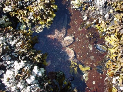
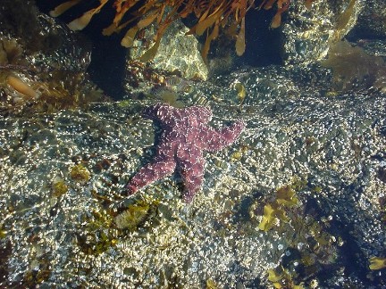
Eventually the wind calmed down enough for us to explore the surrounding islands some, and we discovered a huge oyster bed.  They were big too.  The small ones were about 6 inches and the big ones were almost a foot.

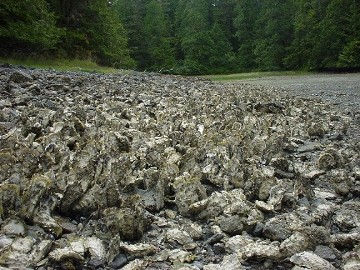
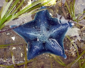
There were hundreds of thousands of them.  The water was strangely warmer here than in most areas, and it encouraged a lot of sea life to grow, like this bright blue star fish, who matches the blue jacket I seem to always be wearing.

After the roughness of the gale had left us, we ventured to the outer edge of the Broken Group.  We went to Wouwer Island, where it is very difficult to anchor.  The only protected spot we could find was a narrow spot inside a little cove with underwater rocks and reefs on either side, and we had to tie the stern to the shore, because there wasn't enough room for the boat to swing around.

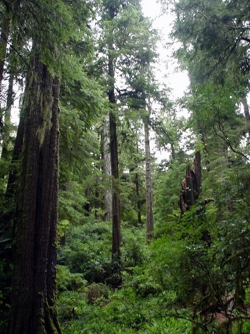
You can't see the line in the photo, but there is a continuous line running from our stern around a tree on the shore and back to the boat, about 300 feet long in total.  The difficulty in anchoring here makes this island rarely visited, especially since it is the furthest out into the open Pacific.   It was full of virgin old growth forest.

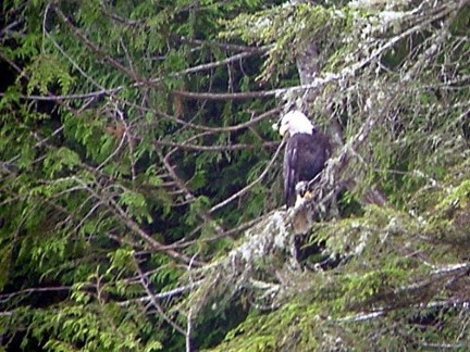
Even the Eagles were not bothered by our presence.

We hiked across the island through the underbrush to the exposed Pacific side.  There were no trails and we had to push our way through the brush.  Exhausted and covered with twigs, moss, and lots of rotten wood bits, we emerged on the other side to a view of the rocky reefs and the Pacific.  There was supposed to be a beach here, and somewhere in the dark green forest we must have lost our bearings and missed it.

We tried to skirt the rocky cliffs and work our way south to the beach, but we were quickly up against large cliffs, so we pushed way back into the thick forest.  After about 20 minutes of fumbling around and not finding the beach, we crossed the island again to return to the boat.  Climbing hills, stumps, scrambling over brush and skirting cliffs we managed to make it back to the other shore.  Only we were cut off from the water by a large cliff.  Drenched in sweat, we reentered the forest and tried to work our way around the large dark cliff wall, until we were up on top of it looking down onto the water.

Performing the classic, "sit and slide" technique, we slid down the steep muddy, mossy embankment to the water line.  From there we were able to work our way back to our starting point and the dinghy.  Sherrell was picking twigs out of my hair and commenting on how the island probably has a few new confusing trails for people to follow.

After recovering from our three hour tour, Sherrell rowed us back to the boat where we collapsed and planned our next stop, Effingham Bay.

Effingham Bay is a somewhat protected anchorage, but what got me excited was the big sea cave on the far side of the island that you can hike to.  So the next day we found ourselves anchored in Effingham and deep inside another old growth forest.  Aren't these places spectacular?!

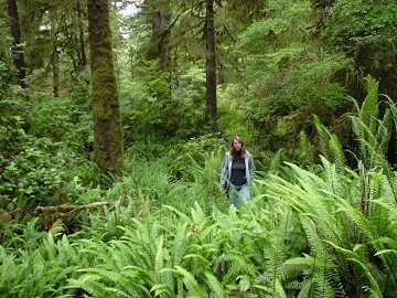
How could ANYONE even think of cutting down these places for cheap timber?  It boggles the mind.  We hiked deep into the forest to cross the island.  Along the way we ran into a large fern meadow, like something from "The Land of the Lost."

Hiking down the beach and scrambling over rocks, we searched for the sea cave.  We heard you can only get into it at low tide, and the tide was rising fast.  After about 1/2 mile of scurrying over rocks, we found it!

Here I am imitating a certain blue starfish.

The cave went way back inside, and stupid me, I forgot my flashlight.  In retrospect, it was probably a good thing, because the tide was quickly rising and soon Sherrell was yelling for me to stop climbing around inside the cave and get out -- the tide had already risen almost a foot.

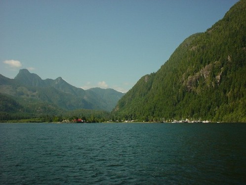
From Effingham Bay, we set sail for Bamfield, the town on the east side of the Sound.  This is the last stop on the west coast for us, as after Bambfield the long slog down the Strait of Juan de Fuca leads us to Victoria, our last Canadian Port.

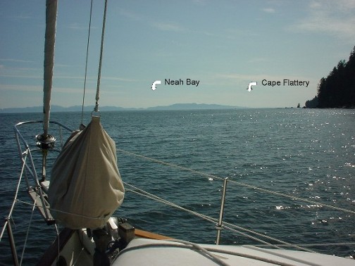
Bamfield was a quaint little town running down both sides of the inlet, where we took showers, did laundry and a little food shopping -- all the cruiser basics.  Then, we headed back out into the Pacific.  Before entering the Straits of Juan de Fuca, we had to travel East for about 15 miles, cross over the Swiftsure Bank, then we would be passing Neah Bay and the entrance to the Straits.

For weeks, we'd listened to the weather in the Straits.  It was always blowing from the West, always.  But the day we sailed around Cape Beale and headed eastward, it was blowing against us, from the East.  Amazing!  We had to motor for 10 hours before entering a large open cove called Port San Juan.  Every Swiftsure race I've been in (all 3), we had strong westerlies.

We saw a lot of little sport fishing boats, and I mean LITTLE - we couldn't believe folks would take these little 10 - 15' boats out to the entrance of the Straits.  But we also saw large commercial bottom draggers, which we still can't believe is legal.  They drop a net in several hundred feet of water and scoop up everything and dump it on the deck of their boat, picking the creatures they want to keep and tossing the maimed and/or dead "by-catch" (animals they cannot sell) over the side.  We went by one as he was pulling up his net, and I kept screaming to the fish, "SWIM DOWN!  SWIM DOWN!  EVERYBODY SWIM DOWN!"  But I don't think they heard me, the bottom dragger pulled them all out of the water and dumped it on their deck.  (If you don't get my reference, you have to see "Finding Nemo").

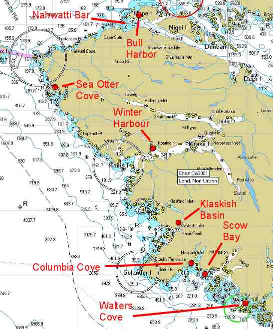
Despite all that, we made good time motoring and headed to a strange anchorage.  Port San Juan looks like someone dipped their finger into an otherwise perfectly straight edged canyon wall lining the south of Vancouver Island for almost 100 miles.  It is a large open bight that is barely out of the swell.  (See the chart at the beginning of this story).

The choice is to either anchor here in this open roadstead, or keep going for another 10 hours or more, arriving in the dark.  We chose to stop, even if it was bouncy.

We set a bow anchor, and lined the boat up so we faced into the swells and then dropped a second anchor off our stern.  This kept us facing into the prevailing waves to make the night more comfortable.

The anchorage was rough, but the view was amazing.  We looked straight out into the Straits and the very Northwestern edge of the United States, Cape Flattery.  We'll have to get more used to anchorages like this for when we head to California and Mexico.

The next day, a westerly gale was predicted.  Well, at least it's a westerly, we both said.  We had over 50 nm to go and a stiff breeze would make the 11 hour day more enjoyable.  As it turned out, we were able to sail a majority of the way and averaged over 5.5 knots (very fast for us considering adverse current for several hours).

The tides were really strong and for the first 3 hours we fought 2+ knots of current, then from there on out, it was like getting sucked down the Strait.  We hit over 9 knots going through Race Passage.  Anyone who has ever sailed in the Swiftsure race, or done any sailing out of Victoria, Canada will recognize the following light.

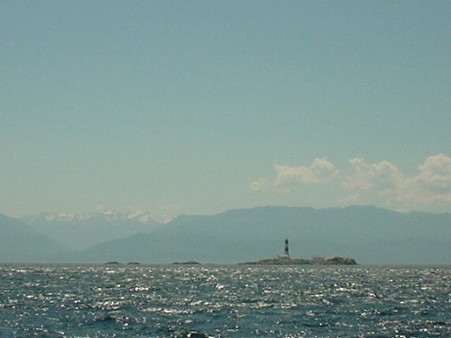
This is the famous Race Rocks about 10 nm outside of Victoria.  It also symbolizes the end of our circumnavigation of Vancouver Island.

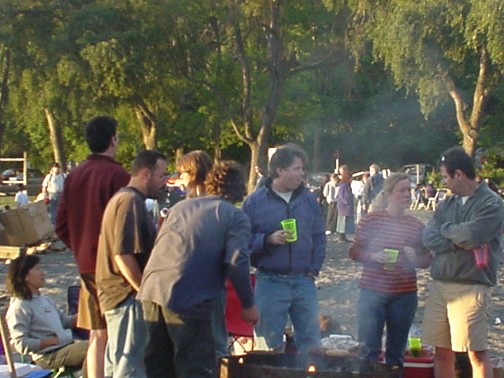
We arrived in Oak Bay in the late afternoon, anchored in a crowded anchorage and toasted our trip with some crappy tasting Canadian beer.

Our last trip through the PNW wilderness was fantastic.  The sailing was usually good, but we still put about 150 hours on the engine--better than the 500 hours to Alaska and back.  Our plan is to make some more modifications to the boat in the next couple of weeks, then make the passage south to San Francisco and beyond!

AFTERWORD: Jezebel's thoughts on the whole matter were rather negative.  If she were to give anyone advice about doing this trip, it would be, "Don't do it!"  She did, however, come out of her shell tremendously.  She's always been a frightened cat, but after facing the open ocean and the big waves, she found a new lease on life.  She comes out of hiding while we are sailing and now she even explores outside the boat on her own.  Two things she hasn't done in over a year of living on the boat.

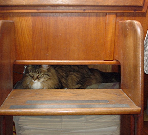
She also found a few new places to hang out and watch the action from, like on top of our chart box under the companionway stairs.
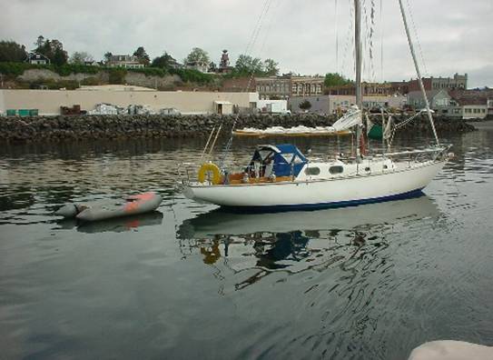
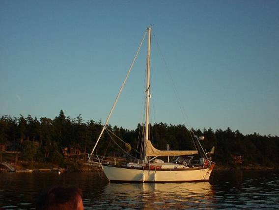